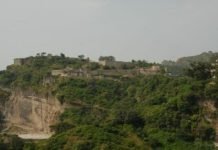
Maharana Pratap Sagar, also known as Pong Reservoir or Pong Dam Lake is a large reservoir in Fatehpur, Jawali. And Dehra tehsil of Kangra district of the state of Himachal Pradesh in India. It was created in 1975, by building the highest earthfill dam in India on the Beas River in the wetland zone of the Siwalik Hills. Named in honor of Maharana Pratap (1540–1597), the reservoir or the lake is a well-known wildlife sanctuary and one of the 49 international wetland sites declared in India by the Ramsar Convention.
Maharana Pratap Sagar Lake
The reservoir covers an area of 24,529 hectares (60,610 acres), and the wetlands portion is 15,662 hectares (38,700 acres). The Pong Reservoir and Gobindsagar Reservoir are the two most important fishing reservoirs in the Himalayan foothills of Himachal Pradesh. These reservoirs are the leading sources of fish within the Himalayan states. Several towns and villages were submerged in the reservoir and many families were displaced as a result.
Location
The closest railway stations to the project are Mukerian, at 30 km (18.6 mi), and Pathankot, at 32 km (19.9 mi). Nagrota Surian and Jawali, located on the periphery of the reservoir, are connected by a narrow gauge railway line, on the Kangra railway line, which connects Pathankot to Jogindernagar. The reservoir is connected by a good network of roads to major cities in Himachal Pradesh and Punjab.
Distance from the Main Cities
- Distance from Shimla – 233.2 km (144.9 mi)
- Distance from Chandigarh – 272.9 km (169.5 mi)
- Distance from Amritsar – 110 km (68.4 mi)
- Distance from Dharamsala – 55 km (34.2 mi)
- Distance from Kangra – 50 km (31.1 mi)
- Distance from Chintapurni – 18 km (11.3 mi)
- Distance from Jwalamukhi – 12 Km (7.45 mi)
Apart from the airports at Chandigarh and Amritsar which are far off, the closest airport to the reservoir is Pathankot and Gaggal. Maharana Pratap Lake to Bharmar Distance 12 km. Wikipedia


